Article
26 March 2025
A new map of seafloor habitat across southern Australia brings unprecedented clarity to the process of focussing marine environmental management.
The map shows the likely presence of ‘functional reef’ across 10–200 metre ocean depths between Western Australia’s Shark Bay and the Victoria-New South Wales border. It was developed in a Marine and Coastal Hub project led by the Institute of Marine and Antarctic Studies (IMAS) at the University of Tasmania and the University of Western Australia (UWA).
Pockets of life
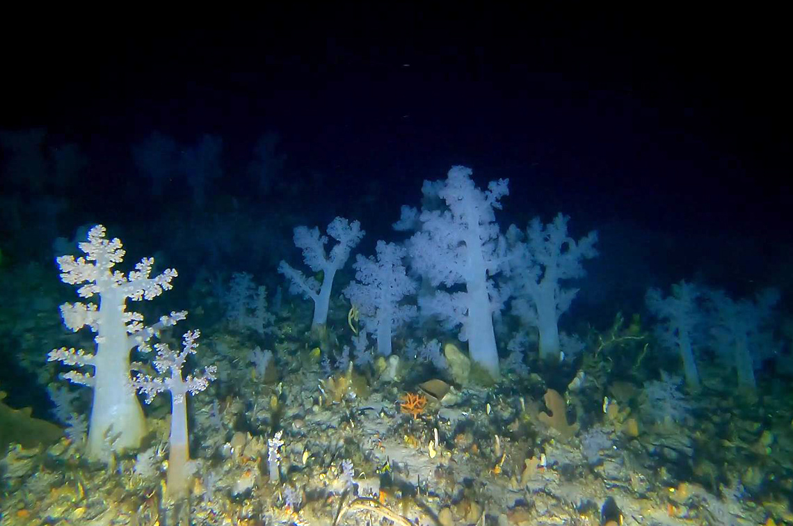
When we think of reefs, we may picture rocky underwater landscapes teeming with colourful fish, seaweeds and corals. The term functional reef broadens this vision to include any area of seabed that acts as reef . . . rocky or not. This may include dense beds of invertebrates attached to soft sediment or shellfish reefs, such as those found in Beagle Marine Park.
Functional reefs add structure and complexity to the seafloor, creating habitat and maintaining healthy ecosystems for countless marine species. They also hold cultural and economic value.
Mapping functional reefs in Australian Marine Parks (AMP) is important to effective park management. Only a tiny portion of seafloor across the vast AMP network has been visually sampled. Park managers therefore rely on model predictions of where else functional reefs are likely to be. Previous maps developed in this way lacked clarity in relation to the underlying data sources and the accuracy of the model predictions.
A map and a compass
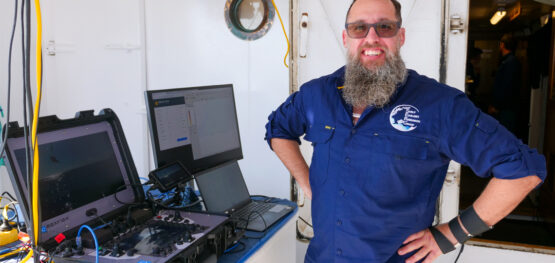
“Parks Australia raised the need to better understand uncertainty about where the data came from and the confidence in what is actually there,” project co-leader Dr Jacquomo Monk of the Institute for Marine and Antarctic Studies at the University of Tasmania says. “We collated existing sampling imagery from 2037 locations and collected 652 additional samples to create a dataset of known functional reef and ecosystem components across southern Australia.
“We used a portion of this data to ‘train’ the model to define relationships with physical ocean features and create a map of where functional reefs and associated ecosystem components are likely to be found. The remaining data was used to evaluate the model results. We were able to model the probability of functional reef with an overall accuracy of ~75% and the probability of ecosystem components at ~73% overall accuracy.”
Touring the reefs
The seafloor sampling imagery used in this project is hosted on Squidle+ and also can be viewed along with the model results on Seamap Australia.
“Thanks to these online platforms we now have an interesting and immersive product that people want to use,” Dr Monk says. “There are spatial pie charts, colours that highlight the complexity of different habitats, and transparencies that provide an indication of confidence we have in our predictions.
“It’s like Google maps compared with a book-based street directory. Park managers can explore a snapshot of what’s potentially living on AMP seafloors across southern Australia. This can be used to design fine-scale sampling programs for areas of interest.
“Importantly, we’ve added the ability to communicate uncertainty. Previously this has been a background statistic not easy to understand in a mapped product.
“We’ve put the model predictions to use in a dynamic way that includes the ‘ground-truthing’ data. Users can see where there is sampling and where there are purely modelled predictions. They can also understand the lineage of the product.”
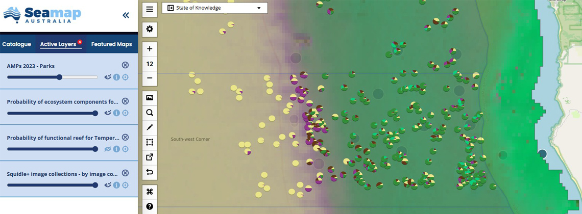 Pie charts depicting the likelihood of ecosystem components in a section of South West Corner Marine Park. Image: Seamap Australia
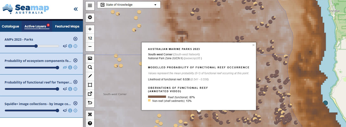
Beyond parks
The new mapping extends well beyond AMP boundaries, providing a step towards possible future fine-scale mapping to:
- identify areas important for conservation, culture and potentially restoration;
- refine ocean accounting estimates for key habitats; and
- locate functional reefs in offshore renewable energy declaration areas.
The project drew on a wealth of research funded by the National Environmental Science Program to develop standard, national approaches to marine research. This includes:
- spatially balanced design to optimise where to sample (including developing a national ground-truth master sample – a shopping list from which new data can be collected to further refine the models into the future);
- best-practice standards published in the Field manuals for marine sampling to monitor Australian waters;
- FAIR (findable, accessible, interoperable and reusable) and open data repositories such as Squidle+ and GlobalArchive; and
- dynamic visualisations on Seamap Australia that enable researchers, policymakers and the public to access and interpret marine data.
“There has been a lot of thinking around avenues of presenting this information, plus a huge amount of sweat and tears collecting imagery,” Dr Monk says. “There’s still a long way to go before we understand how these systems are functioning and changing, but we are making a start.”
This project also involved hub research partners CSIRO, the South Australian Research and Development Institute, and collaborative research with Indigenous agencies: the Binalup Aboriginal Corporation, Esperance Tjaltjraak Native Title Aboriginal Corporation, Undalup Association Inc and Karri Karrak Aboriginal Corporation.
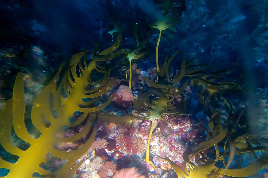 Macroalgae on reef in Franklin Marine Park. Image: IMAS
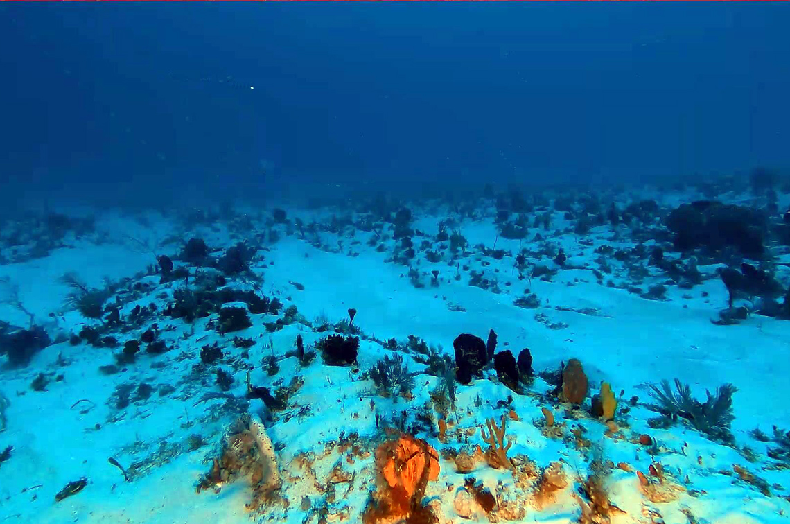
Further reading
- Project 2.1 report: Improving seabed habitat predictions for southern Australia
- Field manuals for marine sampling to monitor Australian waters
- Squidle+ tool for managing, exploring and annotating imagery
- Functional reef mapping on Seamap Australia